What Makes Up "King Tide" Flooding in Hampton Roads?
The "King Tides" that we will map during our citizen science event, “Catch the King Tide”, are correctly called "Perigean-Spring Tides." These are the highest predicted tides of the year given the alignment of the moon, earth, and sun and happen with the fall full/new moons in SE Virginia (highest at least on paper - but more on that in a minute). We can predict these tides years ahead...as shown in the chart below.
The tide chart shows our region's normal cycle of two high tides and two low tides a day. And each month we get higher high tides on the full and new moon, also called "spring tides," when the celestial bodies align as shown in the first picture above. However in the fall of each year are the yearly tide cycles that produce the "King Tides," when the celestial alignment occurs and the moon is closest to the earth - at Perigee.
The chart from 2017 shows a relatively normal high tide in the red circle to the right and the highest perigean tide of the year on our target King Tide mapping day, November 5 in 2017, in the circle on the left. The numbers are the height of the water above Mean Lower Low Water and, in the example above, the November 5 tide will in theory run about 10 inches higher than normal. With no wind, this would cause minor flooding in the lowest lying parts of our region.
But in our region, the wind plays a major part in our water levels, in addition to the daily, monthly, and yearly tides. Without going into too much geeky detail, we have a very rare shoreline with rivers that run south-to-north. (That shoreline is the southern rim of the largest meteor impact crater in the US, a big bang that happened 56 million years ago!) And these rivers are not white-water rivers with a lot of downhill flow - they are flat estuaries with flows that winds can push around. So, when we get a wind from the north, blowing into the mouths of the rivers, the water starts stacking up. Conversely, when we get a wind from the south, the water flows out into the Chesapeake Bay and our flooding is minimal (though with a south wind Back Bay will start flooding but that is another story).
This means that on top of the daily, monthly, and yearly tide cycles we have to figure in the wind. Here's an example of how that works. In this Weather Underground screen shot from October 2016 look at the line of arrows at the bottom, showing the wind speed and direction.
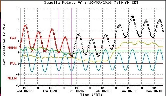
Starting on October 8, 2016, (red circle), the wind shifted out of the N/NE at 20+ miles per hour and started pushing water upstream on our slow-flowing, north facing rivers. Even worse, it kept going for the next few days. This started to cause flooding - as shown in the chart below from the tide gauge at Sewells Point at Naval Station Norfolk. By high tide on the second morning, the tide was 4 feet above mean sea level.
To paraphrase Burt in "Mary Poppins":
"Winds in the [nor]east, mist coming in, / Like somethin' is brewin' and bout to begin. / Can't put me finger on what lies in store, / But I fear what's to happen all happened before. "
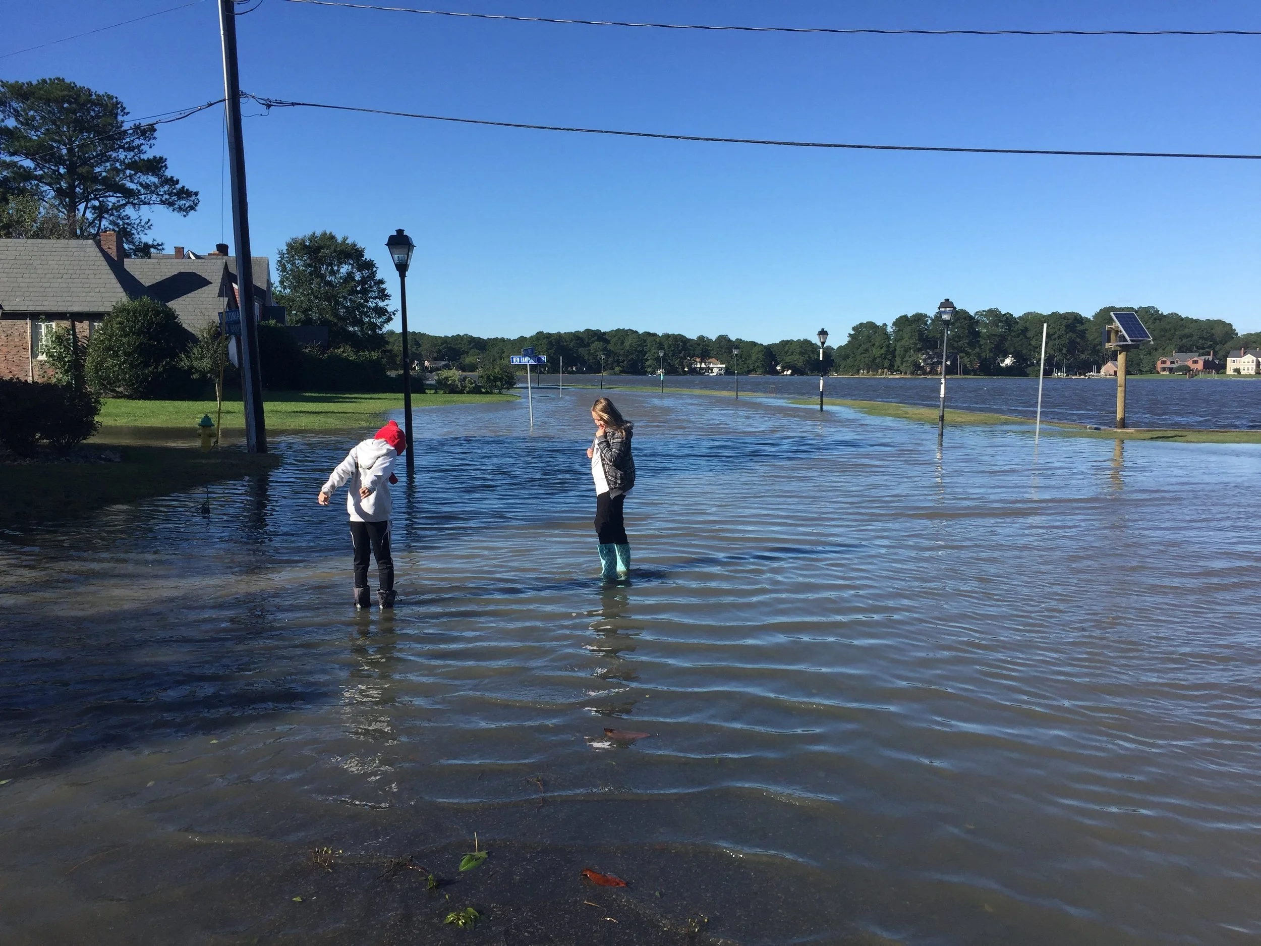
Sure enough, this wind from the nor'east produced nuisance flooding across the region. In Norfolk, it looked like this on October 9, 2016.
Colonial Place gets wet (again) on Oct 9 on a sunny day.
Now we've also got the rain to figure in but we talked about that before.
Enough of the “science” - time now for the “citizen science” to take over and send the mappers out to (safely) map the King Tides!


