Catch the King:
North Carolina
Catch the King: North Carolina
With past funding from NOAA’s Climate Program Office (and NC Sea Grant), and partnership with the North Carolina King Tides Project, we ran a pilot expansion of king tide monitoring in North Carolina. Check it out below!
What is Catch the King?
Catch the King (CTK) is an annual tide mapping event that mobilizes volunteers to collect flooding data during the Perigean king tides, the highest tides of the year. In 2023, we collaborated with the founder and volunteer network of NC King Tides to extend our initiative into coastal North Carolina.
Our community science programs are designed to complement each other, providing a comprehensive view of king tide flooding.
The tool we developed — the Sea Level Rise phone app — captures horizontal flood data documenting the extent of flooding, while NCKT’s Coastal Observer app records photo observations of water levels, providing vertical flood data on water height.
Basically,
Our Sea Level Rise app answers the question: How far inland does flooding go?
NC King Tides’ Coastal Observer app answers the question: How high does the water level get?
For this year’s event (2024), which occurs in the third week of October, we invite participation from organizations, volunteer groups, academics, and local residents along the North Carolina coast. Help us document North Carolina’s 2024 high tide flooding! Scroll further below for instructions.
Help Us Collect Data!
Review the information below and stay tuned for an updated King Tide calendar. Check out the two free mobile phone apps to practice data collection in the meantime!
1. Review the program info sheet to learn more about the two data collection tools and download the mobile smartphone apps: Sea Level Rise and Coastal Observer.
2. Review the tutorial guides for using the Sea Level Rise app (photo|written|video) and the Coastal Observer app.
3. Refer to this location sign-up spreadsheet to find an area to map (if you don’t have one in mind already!) and connect with folks collecting data in your area.
4. Watch the informational webinar (52 minutes) for more details on our project, or view the presentation packed full with information and direct links to resources.
5. Sign up for the CTK newsletter below for event updates and training opportunities.
6. Interested in leading a group effort? Contact Gabi Kinney to learn more about how to get involved.
Click through to the App Store or Google Play using the buttons below to download our Sea Level Rise app! Then, visit our tutorial guide for information on signing up for an official Catch the King event.
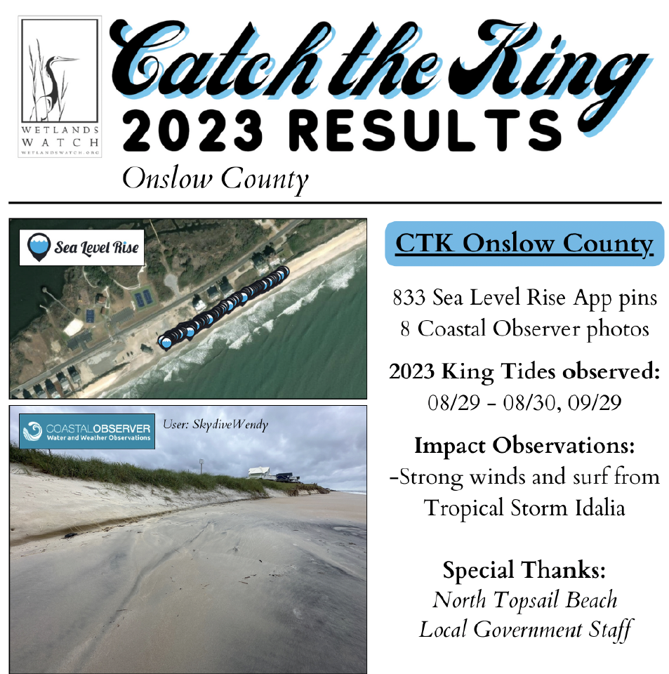
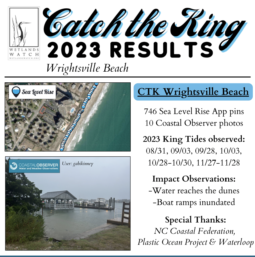
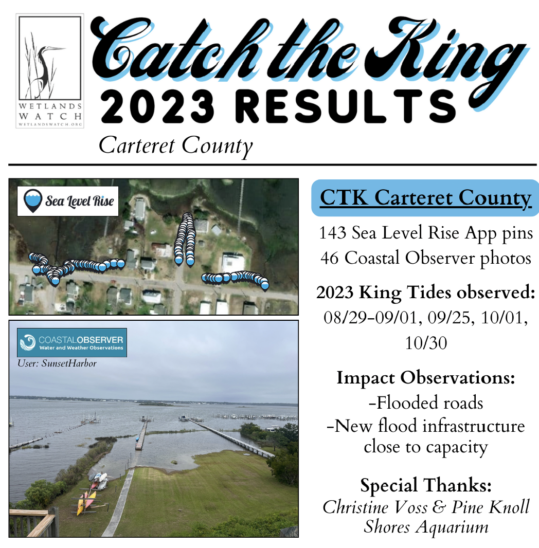
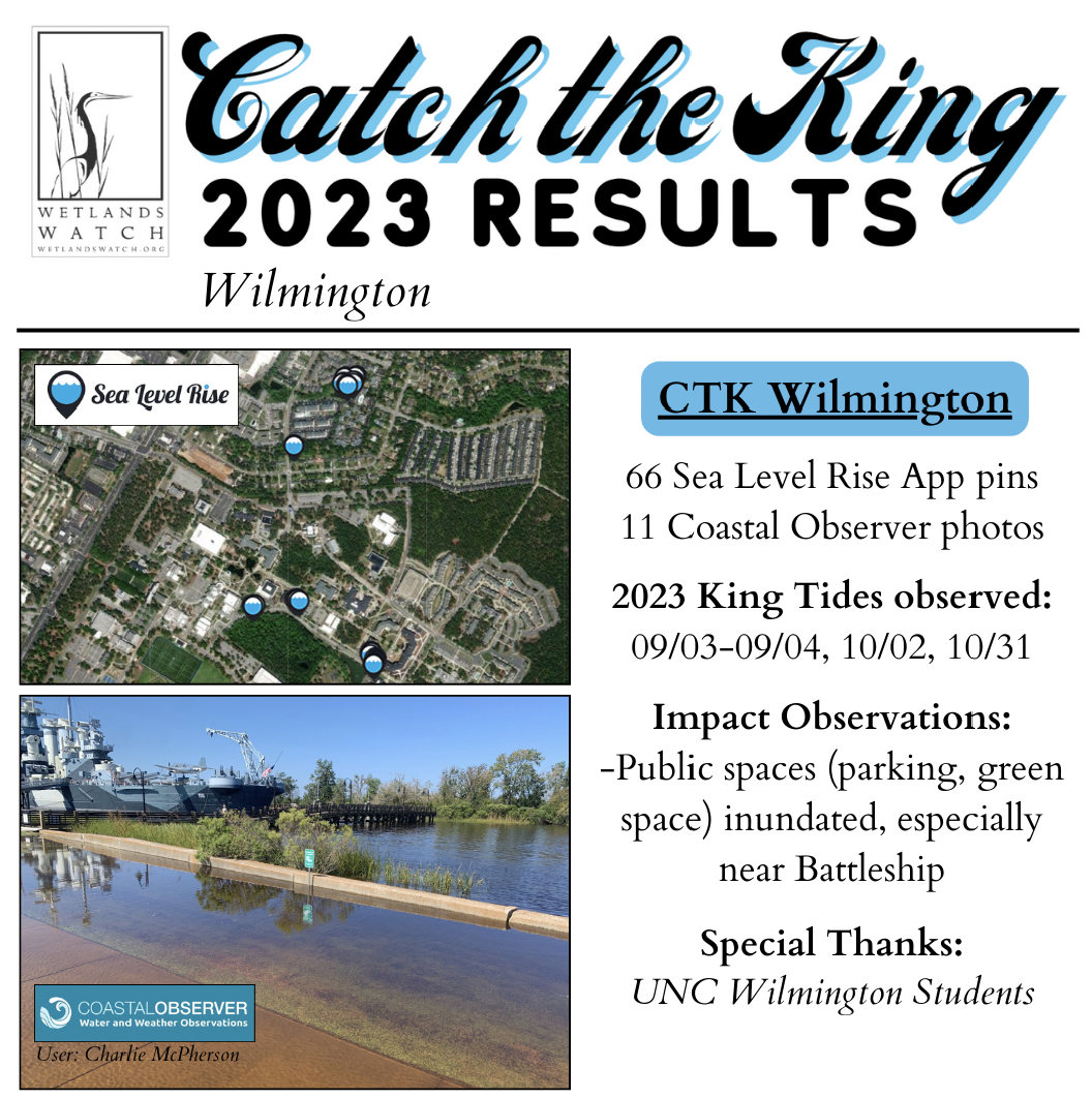
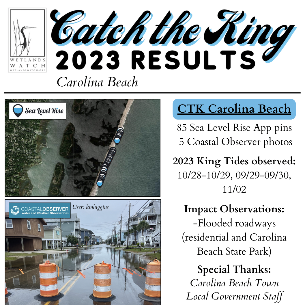
CTK North Carolina 2023 Results
Scroll through the photos below to see a snapshot of the data collected in each of the six NC CTK regions we engaged in 2023.
For a full-screen image, click on the locality you’re interested in here: Onslow County | Wrightsville Beach | Carteret County | Bald Head Island | Carolina Beach | Wilmington. Visit the Coastal Observer website to view more photos collected from each region!
We thank all our sponsors and partners for their support in developing the Sea Level Rise app and organizing Catch the King!

2024 Pilot Feedback Session Video:
2024 Pilot Feedback Powerpoint:
An amazing water-focused podcast, waterloop, hosted by Travis Loop spotlighted our NC pilot, and program lead Gabi Kinney, in episode #204: Catching the King Tides. Watch the episode to the right!
Interested in Catch the King? Stay in Touch!
Catch the King Newsletter
Sign up here for news about the Guinness World Record-holding event!


