Communities Initiative
Mission of the Initiative
We support Virginia localities, particularly those with limited capacity, by offering technical assistance and funding guidance for comprehensive floodplain management and adaptive planning. We work to cultivate and expand a diverse workgroup of practitioners dedicated to peer-to-peer exchanges on innovative ideas and best practices across Virginia’s regions. Finally, we engage members of the public to the tangible effects of climate-induced sea level rise and increased rainfall through media channels, presentations at community events, and engagement with many civic organizations.
Background: Floodplain Management
Floodplain management is how communities manage development and land use in areas of high flood risk, or “floodplains.” Smart floodplain management provides important benefits to communities and residents by reducing the risks and impacts of flooding, helping protect property, infrastructure, and the health and safety of local residents. By implementing effective land-use planning, building regulations, and natural floodplain preservation, communities can minimize flood damage and enhance their resilience to climate-related events like sea level rise and storms.
Programs such as FEMA’s National Flood Insurance Program (NFIP) and the Community Rating System (CRS) help local governments adopt “higher standards” (more protective) for floodplain management, which in turn lowers flood insurance premiums for residents.
Additionally, the CRS Program monetizes the conservation of natural buffers, such as wetlands and open spaces, which absorb floodwaters and reduce runoff, improving both public safety and environmental health. These strategies not only protect communities from immediate flood risks but also build long-term adaptation to future climate challenges.
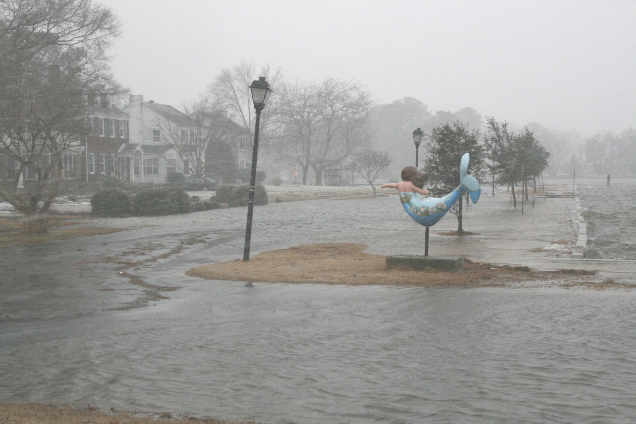
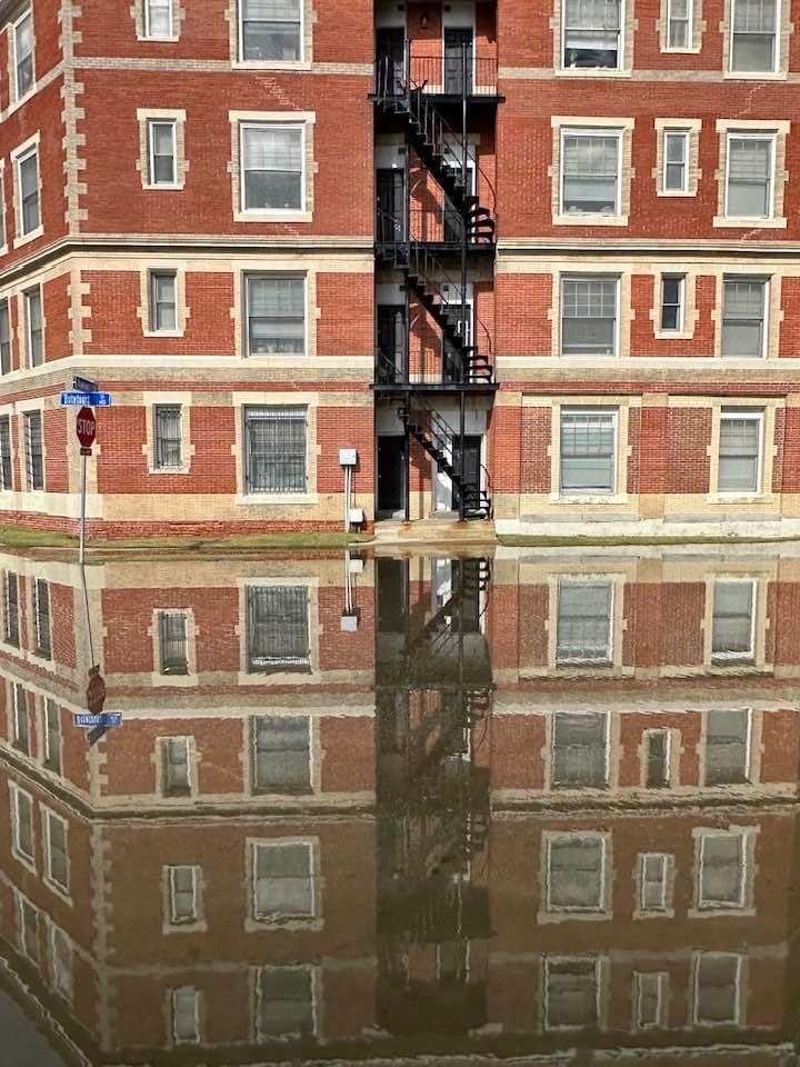
Climate Change Impacts
Climate change is having widespread impacts across Virginia, from coastal flooding in Hampton Roads to frequent flash flooding in the southwest. The state is experiencing more intense storms, increased precipitation (roughly 18% since 2006), and sea level rise, all of which are driving infrastructure disruptions, threatening homes and businesses, and exacerbating social vulnerabilities. A key reference for sea level rise is the Sewells Point tide gauge in Norfolk, which has recorded a 17-inch rise since 1927, nearly double the global average. Projections from NOAA suggest sea levels along Virginia’s coastline could rise by 6.5 feet by 2100.
For more information about climate change impacts, click over to The Changes We have Been Seeing.
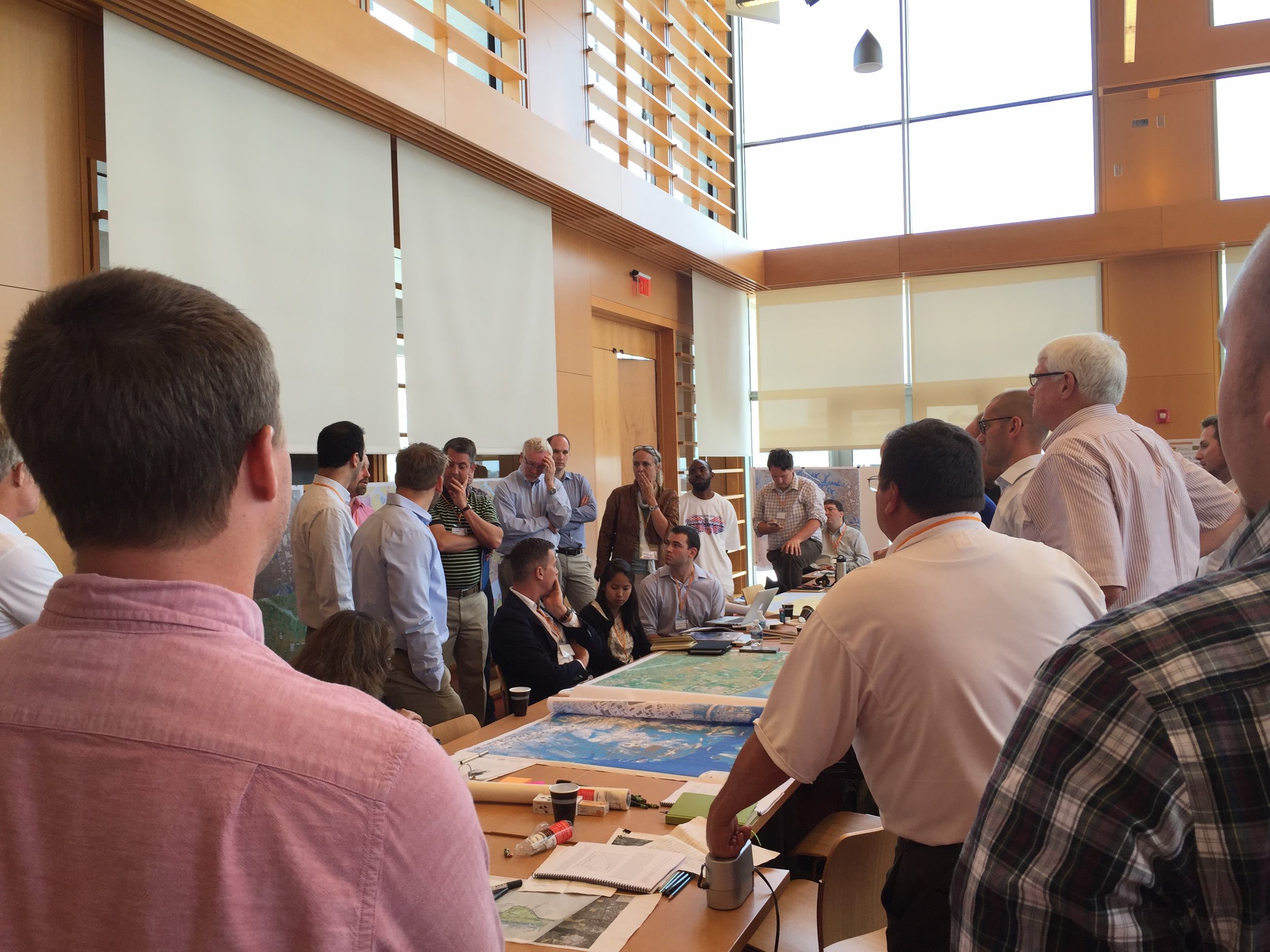
Virginia CRS Workgroup
The Virginia CRS Workgroup assists communities across the state by hosting a community of practice to discuss flood risk reduction planning and participation in FEMA’s Community Rating System (CRS), a program that offers flood insurance premium discounts to localities that implement effective floodplain management practices. Through technical assistance, peer-to-peer exchanges, and collaboration with local governments, nonprofits, and state agencies, the Workgroup helps localities adopt strategies to reduce flood risk, enhance public safety, and manage the rising costs of flood insurance. By focusing on nature-based solutions, such as preserving open spaces and wetlands, the Workgroup ensures communities receive maximum CRS credits, improving both flood resilience and ecological health. Virginia residents directly benefit from these efforts, as improved CRS ratings translate to significant annual flood insurance savings while building long-term adaptation against the impacts of climate change and flooding.
Statewide Flood Preparedness Outreach
This outreach program provides communities with the essential technical guidance and support needed to participate in Virginia’s Community Flood Preparedness Fund (CFPF). The Fund offers financial resources for the planning and implementation of flood mitigation projects, particularly those utilizing nature-based solutions, as well as for capacity-building efforts. The funding is for “pre-disaster” projects and planning, which is important because spending today before a storm reduces the amount of money needed to recover after a storm.
While significant Fund resources are directed toward Virginia’s coastal areas due to the escalating challenges associated with rising seas, Virginia’s non-coastal areas remain vulnerable to climate-driven flooding, but lack resources to adequately address these threats.
Through this outreach program, Wetlands Watch aims to build a comprehensive flood resilience network throughout Virginia, ensuring that all communities have access to the funds they need to reduce flooding.

Coastal Retreat Network
Wetlands Watch created and hosts the Coastal Retreat Network, a national network of climate adaptation professionals interested in on the ground strategies to remove people from risk in coastal regions. The network is composed of many different professionals—scientists, lawyers, government staff, professors, and other thought leaders. By connecting these stakeholders, the Network helps practitioners manage the natural inland migration of coastal wetlands through the development of policies, regulatory frameworks, and best practices that promote sustainable land use and habitat preservation.
Membership in the Coastal Retreat Network is free and includes access to a listserv and quarterly Zoom meetings. Members can learn about ongoing and developing projects in coastal communities, primarily across the U.S., and utilize the forum to seek advice from other professionals, request referrals, and more.

We are in the process of updating the Adaptation Guide, and are looking at a release date of late 2025. In the interim, please visit the guide on our own side via the button below.
Virginia Sea Level Rise Adaptation Guide
Wetlands Watch’s Sea Level Rise Adaptation Guide (“Adaptation Guide”) is a key resource designed to support Virginia’s local governments in addressing the urgent challenges posed by flooding and sea level rise. The guide consolidates a wide range of technical, legal, and strategic information, empowering localities to take immediate, actionable steps toward climate adaptation. It provides insights into effective floodplain management, land use strategies, and policy frameworks, helping local governments navigate the complexities of climate change adaptation.
By offering practical tools, case studies, and regulatory guidance, the Adaptation Guide equips decision-makers with the knowledge to protect vulnerable communities, integrate nature-based solutions, and implement long-term planning for flood risk education. This comprehensive effort aligns with Wetlands Watch's mission to bolster local capacity, ensuring that even smaller or resource-constrained communities can engage in effective climate adaptation planning and action.