Catch the King
Catch the King (CTK) is a community science program that mobilizes volunteers to map the extent of tides and flooding during the fall season of perigean spring tides, commonly known as “king tides,” in Virginia. During the king tide, participants use a mobile app to collect location-based data points along the water's edge at peak high tide.
This data improves flood forecasting computer models at the Virginia Institute of Marine Science (VIMS) developed by Dr. Derek Loftis. These models are used by planners, engineers, and local leaders to make informed decision about how our communities adapt to sea level rise and reduce flooding impacts.
Quick Links
Get Involved
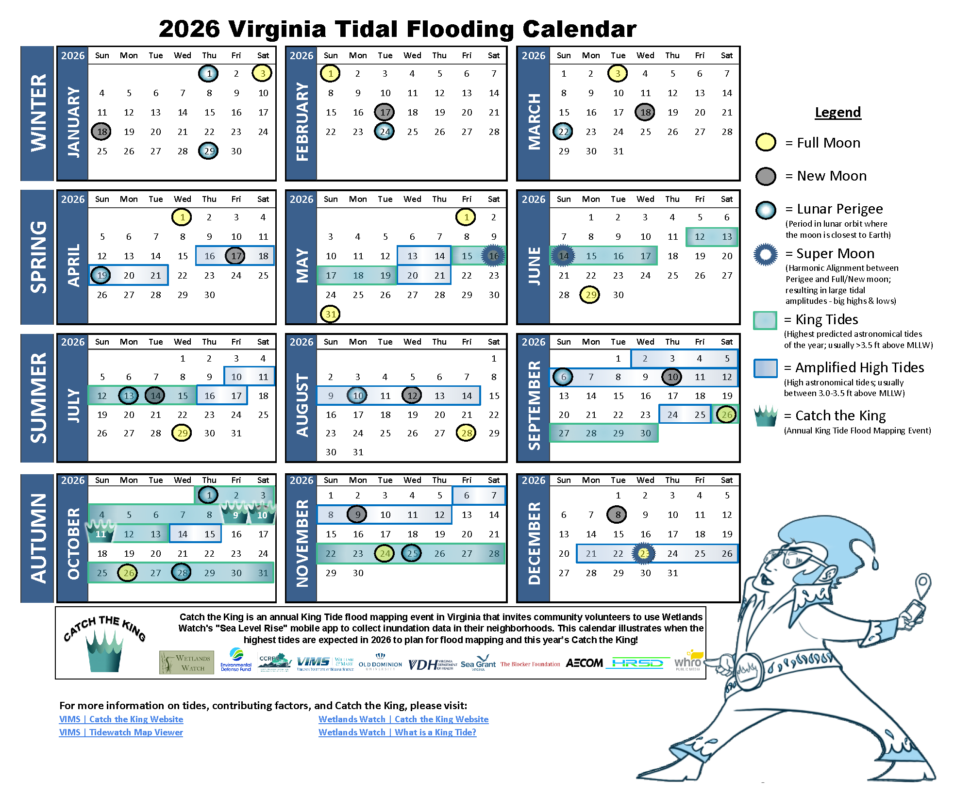
Save the Dates for 2026
Sept 11 - 13: Wet Run (practice & data collection)
Sept 12: Measure the Muck
Sept 26 - Oct 1: Sept Full Moon Mapping
Oct 9 - 11: Official Catch the King Event!!!
Oct 10: Measure the Muck
Oct 25 - 30: Oct Full Moon Mapping
Click here to open the 2026 CTK Flyer.
Click the image or here to open a PDF version.
1) Fill out the 2026 Volunteer Interest Form!
You can review the volunteer information sheet and watch the video to learn more about participating in CTK.
To become a Mapper each fall, give yourself enough time to prepare, practice, and follow the instructions below:
What’s it like to be a Tide Mapper? Learn more in this video by WHRO Public Media.
In 2026, MTM sampling will center around: 1) the Elizabeth/Lafayette Rivers in Norfolk, Chesapeake, and Portsmouth; 2) the York River System in Gloucester, York County, and Poquoson; 3) the James River in Newport News; 4) Potentially the Eastern Shore!
In certain regions, you can also dive deeper while mapping by collecting flood water quality samples. Check out Measure the Muck (MTM) with our partners at Old Dominion University and indicate your interest on the 2026 Volunteer Interest Form.
2) Download & register for the Sea Level Rise app* (clickable buttons below):

*Note: at this time, the Sea Level Rise app requires cellular service or Wi-Fi for mapping.
3) Visit the Catch the King Toolkit for the step-by-step tutorial guide and more on how to use the app, when and where to map, and find upcoming trainings near you.
You may self-train using the provided resources, however touching base with the CTK Coordinator is recommended to ensure you are set up for success for mapping on the big day. It is highly encouraged to practice mapping in the app prior to the event. You can do this in the “CTK TRAINING” region.
Get Connected
Sign up for the CTK newsletter to receive event updates.
Join our Facebook group, Help Catch the King Tide to connect with other volunteers.
Interested in being a Tide Captain? Check out our info sheet on being a tide captain and let us know you’re ready to take the lead by sending us an email.
Follow Wetland Watch’s social media to learn more about our work.