Changes We Are Seeing
Climate Change Impacts
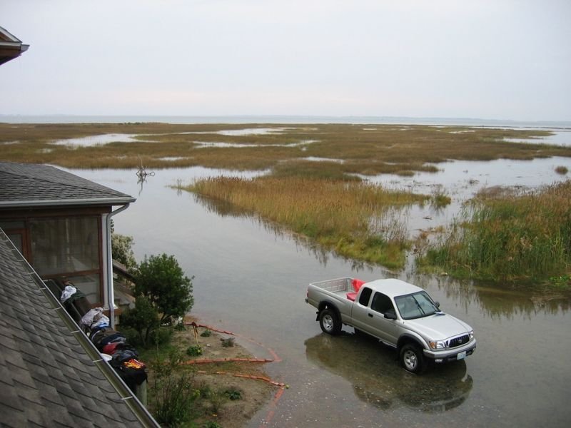
Our changing climate impacts regions across Virginia. From coastal flooding in Hampton Roads to mudslides in Buchanan County, communities throughout the Commonwealth are facing more intense storms and increased precipitation. These events are driving widespread disruptions to infrastructure, threatening homes and businesses, and exacerbating social vulnerabilities in low-lying and inland areas alike.
The increasing frequency of such climate-related hazards is placing significant strain on local governments and residents, who are struggling to adapt to these evolving threats. As these challenges intensify, the need for comprehensive resilience strategies, including natural solutions like wetland restoration and shoreline buffer enhancement, becomes ever more urgent to safeguard both people and ecosystems across Virginia.
Learning Series: Sea Level Rise in Virginia (April 9th, 2021)
Wetlands Watch's Senior Advisor and Founder, Skip Stiles, presents an overview of sea level rise in Virginia. The talk includes the science, impacts, and current policies to help communities adapt.
Sea Level Rise: Trends and Projections
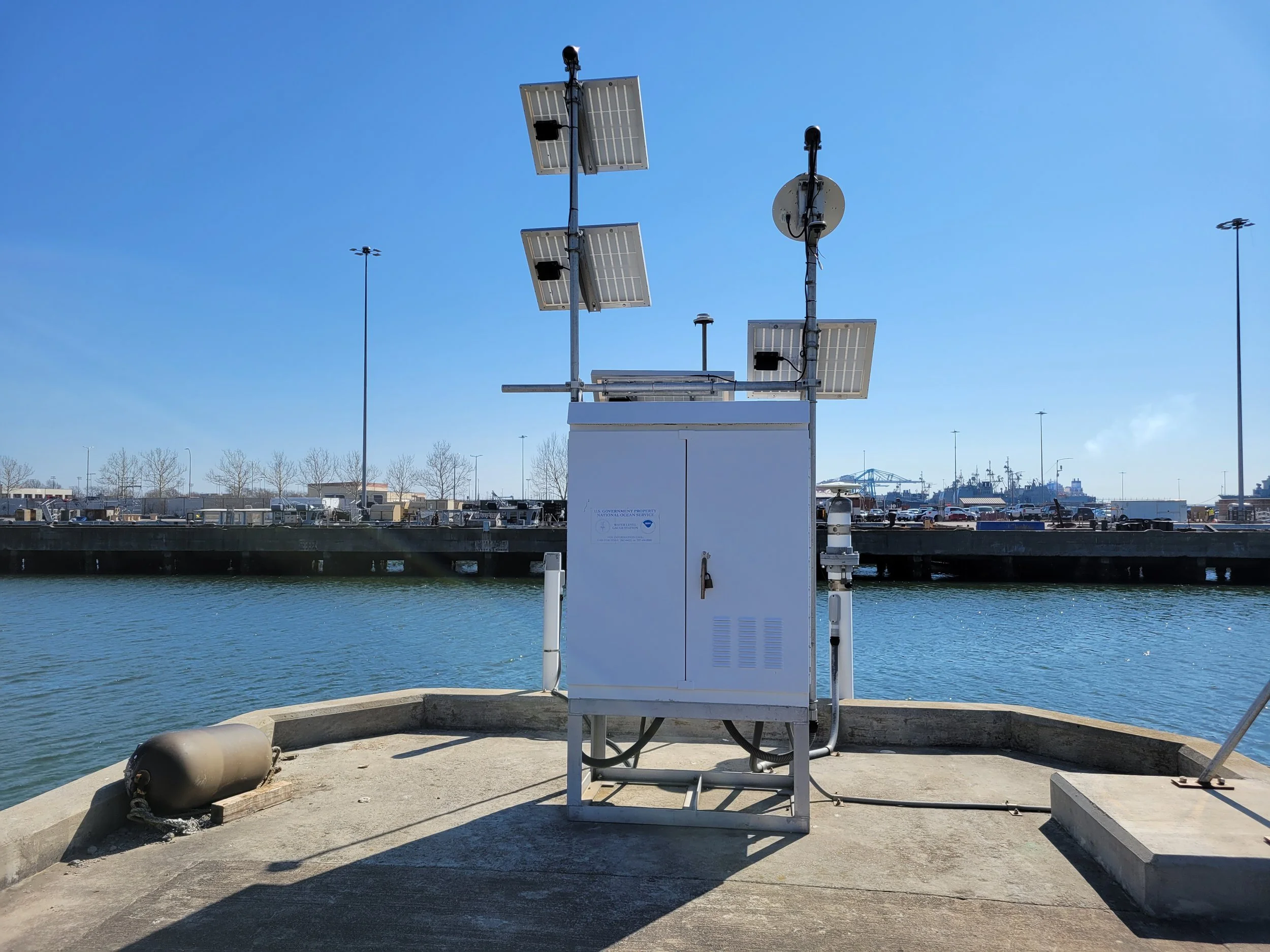
Sewells Point Tide Gauge
The Sewells Point tide gauge, located in Norfolk, VA, is one of the oldest in the Chesapeake Bay, dating back to 1927. It serves as a key reference for tracking sea level rise in Virginia. Since 1927, sea levels at Sewells Point have risen by 17 inches, nearly double the global average for sea level rise, making it a key indicator for regional climate impacts.

Causes of Accelerated Sea Level Rise in Coastal Virginia
Coastal Virginia experiences a significantly higher rate of sea level rise than other U.S. coastal areas due to a combination of natural and human-influenced factors.
Land Subsidence
One of the primary drivers of this accelerated relative sea level rise (RSLR) is land subsidence, which accounts for nearly half of the region's RSLR. Subsidence rates in coastal Virginia range from 1.1 to 4.8 mm annually, driven by both geological and human-induced processes. Natural subsidence is largely the result of the Chesapeake Bay impact crater, a geologic formation that continues to cause gradual sinking in the region, as well as glacial isostatic adjustment (GIA). GIA occurs as the Earth's crust slowly rebounds from the immense pressure exerted by glaciers during the last Ice Age, causing portions of the Mid-Atlantic region, including coastal Virginia, to sink.
Groundwater Extraction
Human activities have further compounded the subsidence problem. Groundwater extraction, primarily for agriculture and urban use (paper-mills too), has led to the compaction of aquifers and the region’s water table, contributing to additional subsidence at rates of 1.5 to 3.7 mm per year. This human-induced subsidence has significantly worsened the already vulnerable coastal zones.
Slowing of the Gulf Stream
Another key factor is the slowing of the Gulf Stream, a critical ocean current that helps regulate sea levels along the Atlantic coast. Over the past several decades, the Gulf Stream has slowed by approximately 15%, and it is projected to slow by an additional 34-45% by 2100. This deceleration contributes to a regional rise in sea levels, as the weakened current leads to the accumulation of water along the Mid-Atlantic coastline, further exacerbating RSLR in coastal Virginia.
These combined natural and human-driven factors make the region particularly vulnerable to the impacts of sea level rise, with significant implications for flood risk, coastal infrastructure, and ecosystem health.
For more detailed information, explore the USGS Report, “Land Subsidence and Relative Sea-Level Rise in the Southern Chesapeake Bay Region.”
Sea Level Rise Visualization Tools
AdaptVA offers visualization tools using USACE and NOAA curves, along with the VIMS 2050 projection for Sewells Point.
NOAA Sea Level Rise Viewer visualizes potential coastal flooding areas and the relative depth of impacts.
Increased Precipitation

The impacts of climate change extend far beyond the coast. Warmer air holds more moisture, leading to extreme rainfall events—sometimes referred to as "rain bombs"—that can overwhelm stormwater systems. This makes it important to assess not only annual rainfall totals but also the intensity of individual precipitation events. A study by Peter Pommerenk of the City of Virginia Beach highlights this issue. As shown in the adjacent image, while the number of rainy days at Norfolk International Airport has remained stable, there has been a significant increase in high-intensity rainfall events from 1950 to 2015.
In October 2016, Hurricane Matthew caused severe flooding in Virginia, with some localities receiving 14-18 inches of rain within 12 hours. Following this event, the City of Virginia Beach worked with Dewberry to conduct a comprehensive analysis of historical and projected heavy precipitation, confirming the growing frequency of intense rainfall events.
State and local governments are now incorporating these changing conditions into their planning. Virginia Beach has taken the lead, using the Dewberry Study to update its stormwater design standards. For more information, see Responses to the Changes We Have Been Seeing. Additionally, the Virginia Department of Transportation has integrated sea level rise and increased precipitation into its structure and bridge design manual.
“Research by the Virginia Transportation Research Council found consistent bumps in rainfall and intensity statewide, leading the Virginia Department of Transportation in 2020 to order that ‘a 20 percent increase in rainfall intensity and a 25 percent increase in discharge shall be used in design of bridges.’” Virginia Mercury.