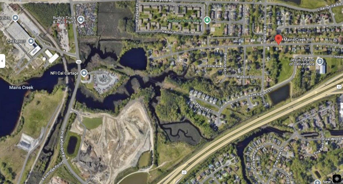
Mains Creek
In the Mains Creek neighborhood of Chesapeake, students have been exploring design strategies to enhance green infrastructure in and near vacant residential lots that are the result of high flood risk property acquisitions. Several Collaboratory projects have focused on this neighborhood because communities across the country are exploring what to do with empty land that remains after a property buy out occurs. This area provides an interesting design challenge for students, as residents of communities that have had properties bought out and demolished often complain about the impact on community character. The Mains Creek designs also supported Wetlands Watch’s Conservation Pilot Project.

“Designing the Future of Coastal Virginia Beach & Chesapeake” (2020)
Dr. Mintai Kim’s annual Fall 2020 coastal resilience design studio with the Virginia Tech landscape architecture students provided an opportunity to look at broader geographic scales. Students looked at sites in both Virginia Beach and Chesapeake. In Mains Creek, the students created passive recreational opportunities on five vacant parcels located along the Mains creek.
Reports:
“Designing the Future of Coastal Virginia Beach & Chesapeake Report: Part One” (2020)

“Designing the Future of Coastal Virginia Beach & Chesapeake Report: Part Two” (2020)


“The Belmont Meadow Park Project” (2021)
A neighborhood park for Chesapeake, Virginia that allows nature to reclaim space, restoring native wetland species while providing a restorative community gathering space. These interventions will provide the surrounding community with a relaxing space of recreation while highlighting the aspect of minimal future site maintenance.
Video presentation of the project:
Presentation:


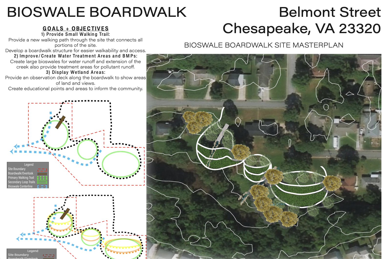
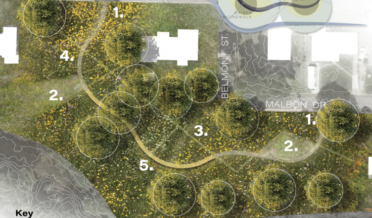
“The Bioswale Boardwalk Project” (2021)
The project aims to enhance the accessibility and environmental resilience of the Mains Creek area through the creation of a small walking trail system and improved water management features. A boardwalk will be constructed to connect various parts of the site, offering an easier, more accessible path for walkers, including those who may struggle with uneven terrain.
Bioswales will be created to manage stormwater runoff, improving water quality by filtering pollutants before they reach nearby creeks. The design incorporates tiered trails, allowing continued use as sea levels rise, with elevated walkways providing a durable path even as lower trails become unusable. Observation decks and educational signage along the boardwalk will encourage community engagement, offering scenic views of wetlands and an opportunity to learn about local ecosystems and water treatment strategies. This project provides a unique space for nature appreciation while enhancing the site's resilience to environmental changes.
Reports & Presentations:
“The Bioswale Boardwalk Project Report”
“The Bioswale Boardwalk Project Presentation”


“The Color Cord Trail Project” (2021)
The Color Cord Trail project in Chesapeake, Virginia, is designed to weave together land, community, and natural ecosystems while adapting to the region's unique environmental challenges, such as flooding and sea level rise. This innovative trail system connects a network of public spaces, integrating woodlands, wetlands, and wildlife habitats into the fabric of neighborhood life.
As vacant lots are repurposed for communal and ecological use, the trail strengthens its roots throughout the area, allowing visitors to engage with and nurture natural flooding events. The design emphasizes adaptability, creating a lasting model for both people and wildlife to experience and thrive in the ever-changing Chesapeake landscape. Through this project, the community gains access to outdoor spaces while fostering a deeper connection to nature's processes.
Video Presentation & Presentation:


“Community Eco-Space” (2021)
The Community EcoSpace in Chesapeake, VA, is designed as a multifaceted green space that blends ecological restoration with community engagement. The site incorporates a living shoreline-like "island" and wetland restoration along the bank, featuring indigenous species such as Spartina to create a natural barrier against flooding. A swale system stores water during flood events, with a pipeline discharging excess water into a nearby creek, ensuring the space remains resilient in the face of environmental challenges.
The wooden trails, which are ADA-compliant and wheelchair-friendly, meander through the site, providing opportunities for jogging, trekking, and restorative activities. The meadow field, adorned with native trees like Trident Maples, Oaks, Pines, and flowering species like Goldenrod, offers open space for picnics, community gatherings, and relaxation. Facilities such as benches, grills, and pet waste eliminators further enhance its accessibility, making this eco-conscious design a functional and enjoyable area for the local community.
Presentations & Videos


“A Fertile Edge: A Regenerative Agroforestry System to Turn Empty Lots into Productive Forests” (2021)
This project explores how empty lots may be turned into productive forests that provide food opportunities for the local residents, and havens for local wildlife.
Presentations & Videos:

“Restoring Wetlands: A Wetland Restoration Project & Neighborhood Park for Chesapeake” (2021)
This project proposes to transform a set of five vacant parcels in Chesapeake, Virginia, into a neighborhood park that begins the process of wetland restoration for the adjacent Mains Creek. A simple and low maintenance park will provide a getaway for residents who will be able to witness how wetlands reclaim these low-lying areas.
