Wetlands Migration Planning
Introduction
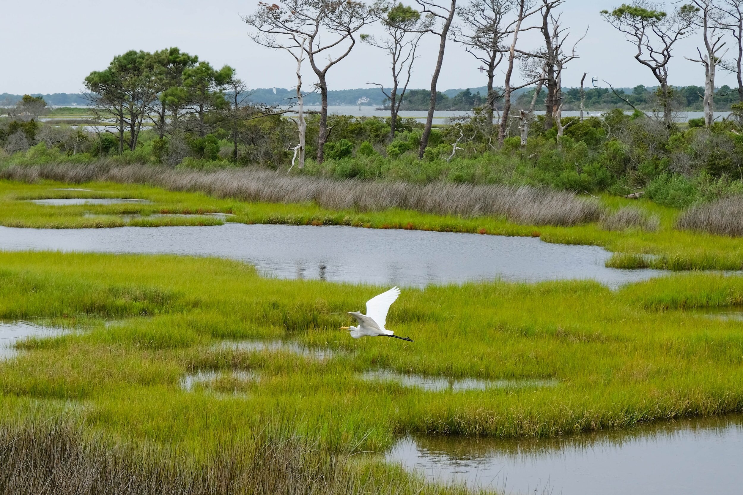
Wetlands are complex, dynamic, and productive ecosystems that serve as transition spaces–hinge points–between land and water. Wetlands define areas that are constantly changing. Wetlands recede in droughts and expand in times of heavy rainfall. Along the coast, they embrace and release water with the tides.
For hundreds of thousands of years, Virginia’s wetlands have proven remarkably resilient to changes in sea level. As the sea level dropped, they migrated seaward to seize ground that was closer to the water. As the seas rose, they migrated landward to escape drowning. That was the past, but today things are different.

The Challenge
Virginia’s wetlands were able to adapt to changing climate conditions in the past, but scientists predict they will not be able to adapt to current conditions without help. Seas are rising faster than at any other time in the last twenty-seven centuries. The sea level at Sewell’s Point in Norfolk has risen 1.5 feet in the last hundred years, and is projected to rise another 1.5 feet by 2050. The problem is that the vertical growth rate (sediment stacking up so plants can grow on top) of wetlands is slower than the sea level rise rate, so wetlands are drowning in place. Without help, Virginia is projected to lose 89% of its tidal wetlands by 2100.

The only way our wetlands will survive sea level rise rates is to add more sediment on top of existing wetlands (“persist in place”) or allow them to migrate landward. The biggest question is whether there are enough open lands on which wetlands can migrate. Virginia’s shorelines are 98% in private ownership, with seawalls, bulkheads, rip rap, residential property, and other human infrastructure, like roads, in the way. For the first time in their long history, Virginia wetlands have nowhere to go as the sea level rises, and risk drowning in place.
The Solution: Wetlands Migration Planning
Building Resilience to Rising Seas through Wetlands Conservation
Wetlands migration planning is an innovative form of land use planning and policy that strategically anticipates and manages the adaptation of tidal wetlands in response to rising seas. This form of planning involves identifying areas where wetlands can naturally migrate inland or be restored in place to maintain their ecological functions and biodiversity.
Wetlands Watch was one of the first state environmental groups in the country to begin work on wetlands migration planning. Beginning in 2007, Wetlands Watch shifted our entire organizational approach in response to a Virginia Institute of Marine Science study that estimated Virginia would lose between 50 and 80 percent of its remaining vegetated tidal wetlands by 2100 due to rising seas. Without intervention, the report concluded that these tidal wetlands were at severe risk of drowning in place.
The major obstacle is that much of coastal Virginia is developed, and hardened shorelines like bulkheads and revetments render wetland migration all but impossible. Aside from the fact that hardened shorelines are expensive to install, expensive to maintain, and represent only a temporary stop-gap shoreline protection measure, they prohibit wetland migration, meaning Virginia’s wetlands will drown in place as the seas rise.

Identifying Potential Migration Paths
In 2024, Wetlands Watch had the honor of working with the NASA DEVELOP program to determine how much of the enormous wetlands loss in Hampton Roads and Virginia’s Eastern Shore could be mitigated through the strategic conversion of urban areas into ideal wetland habitats. NASA’s predictive models concluded that active human intervention is crucial for the survival of Virginia’s wetlands, and a necessary step to ensure that these highly productive coastal ecosystems are protected from the impacts of sea level rise.

Pioneering Innovative Legal Tools and Methods
As wetlands migration planning emerges as a vital strategy to address the unprecedented challenge of catastrophic wetlands inundation in Virginia, Wetlands Watch is at the forefront of developing innovative methods and tools to streamline and vitalize the planning process.
One of our most significant projects in this area has been the Rolling Conservation Easement and Conservation Pilot Project (2021-23). In this pilot project, Wetlands Watch worked with the Coastal VA Conservancy to help local governments develop sea level rise retreat policies that were in alignment with evidence-based conservation principles. The effort sought to address the emerging challenge of determining ownership and management of inundated land once structures are removed.

Wetlands Migration Planning Process
A major component of our work centers on encouraging local governments, landowners, and developers to allow coastal plains to revert to their natural state as the seas rise. We begin the process by assessing vulnerable wetlands and identifying favorable inland migration pathways. We then work with our many partners to create policy and regulatory frameworks to actualize these pathways, and develop innovative legal tools when they are appropriate. Finally, we ensure that living shorelines are designed, implemented, and maintained in accordance with best practices and climate change conditions, and conduct community outreach and education efforts to help create community enthusiasm around these actions.
Some details and highlights from the process:
Assessing Vulnerable Wetlands
Virginia has no shortage of vulnerable wetlands. The Virginia Coastal Resilience Master Plan - Phase I forecasts that an estimated 89% (170,000 acres) of existing tidal wetlands, and 38% (3,800 acres) of existing dunes and beaches will be permanently inundated and replaced by open water by 2080.
That’s nine of every ten acres of wetlands lost, and more than one of every three acres of beaches.

Developing Policy & Regulatory Frameworks
Wetlands Watch, in coordination with its many partners, develops and enforces policies that support wetland migration. These include setbacks from shorelines, restrictions on development in sensitive areas, and incentives that reward consequential conservation actions. Through our efforts, and the efforts of our partners, the Commonwealth of Virginia has passed legislation that promotes and incentivizes living shoreline wetlands as the default design standard and must account for sea level rise in the Tidal Wetlands Act.

Designing & Implementing Living Shorelines
The design and implementation of living shorelines is a complex task that requires specialized training and expert guidance.
Wetlands Watch provides this training to living infrastructure professionals working along the shoreline through the Chesapeake Bay Landscape Professional (CBLP) program. We also provide technical guidance to stakeholders through the Living Shorelines Collaborative.

Engaging & Inspiring Communities
Central to Wetlands Watch’s work is educating, engaging, and inspiring the communities with whom we partner. For instance, to educate the public about the realities of sea level rise, we conduct an annual Catch the King event. This exciting crowdsourcing event, held every Fall, presently holds the record for “most contributions to an environmental survey” in the Guinness Book of World Records.
A Welcome Assist from NASA
Wetlands Watch is honored to be partnering with NASA DEVELOP to employ NASA's advanced Earth observation technologies to combat the alarming rate of wetlands loss in Hampton Roads and along Virginia's Eastern Shore. In the first stage of the project, Wetlands Watch worked with data scientists Katherine Kivimaki, Mitchell Johnson, Brooklyn Appling, and Sean Asbrand over the course of sixteen weeks to answer the following question:
How much of the enormous wetlands loss in Hampton Roads and Virginia’s Eastern Shore can be mitigated through the strategic conversion of urban areas into ideal wetland habitats?
Background
Wetlands are critical ecosystems that offer numerous benefits to Virginia’s communities, including flood damage protection, water purification, and providing natural habitat for the state’s abundant wildlife. Ideally, as the seas rise, and the shoreline retreats landward, wetlands would follow and continue to provide rich benefits to Virginia’s communities.
Unfortunately, this natural process has been hindered by decades of urbanization. Impervious surfaces such as roads and buildings physically block the inland migration paths that wetlands would ordinarily follow in response to rising seas. Because of these physical barriers, wetlands will not be able to migrate and risk drowning in place.
Adding to these challenges, the Supreme Court in Sackett vs. EPA significantly reduced federal protections for wetlands dependent on groundwater or precipitation, exposing these vital areas to the threat of development. This decision exacerbates an already dire situation by making it increasingly difficult to preserve the remaining migration paths and ideal habitat essential for wetland survival.
Predictive Modeling
In outlining the scope of the project, Wetlands Watch and NASA DEVELOP established a geographical boundary that included the majority of coastal communities across the greater Hampton Roads region (including the Middle Peninsula) and Virginia’s Eastern Shore. While processing data, NASA data scientists factored in scenarios for urban conversion potential, human-made “anthropogenic” barriers (such as buildings), projections of intertidal zone shifts, existing land slope conditions, and wetland migration rates to create data-informed images of the extent of future wetlands and where there is potential to reduce wetlands loss through urban conversion.
Using the scenarios described, the NASA team's model, based on processed data, forecasts that rising sea levels will result in an approximate 80% reduction in wetland areas by the end of the century. This aligns with the estimates of ongoing wetlands modeling at the state level, namely the Virginia Coastal Resilience Master Plan (CRMP)’s projection of 89% loss of all tidal wetlands by 2080 based on existing land use conditions and with no consideration of marsh migration. Consult this video for a visualization of this forecast in Poquoson. (It's important to note that while the Coastal Resilience Master Plan encompasses the entire geographical area of Virginia's tidal wetlands, the NASA DEVELOP project targets a smaller subset of that area.)


The NASA DEVELOP modeling advances these analyses by estimating how much of the projected 80% total wetland loss could be mitigated if communities transform urban areas into optimal wetland habitats. This includes buying properties that frequently experience flooding and converting them into open spaces that are conducive to marsh migration.
NASA's urban conversion suitability analysis revealed that up to 41% of the wetlands projected for loss by 2100 could be preserved if communities within the defined geographical area converted all regions with medium to high conversion potential into optimal green spaces. This assessment was based on the proportion of "natural" green space in each area—for instance, a coastal agricultural field on the Eastern Shore, with its higher ratio of natural versus built environment–has a greater potential for conversion than the more urbanized downtown portions of Portsmouth, Hampton, or Norfolk.
Active human intervention is essential for the survival of Virginia’s wetlands. The situation is critical, and there is no one strategy that is equal to the challenge. Even if all NASA-identified areas suitable for conversion are converted to wetlands, Virginia’s coastal communities will still encounter severe wetlands losses as sea level rise outpaces the vertical growth of marsh plants. Localities with steep, eroding cliffs along coastlines, such as Suffolk or those along the Rappahannock River in the Northern Neck, have even greater land use challenges to overcome in researching the feasibility to preserve in place and/or facilitate migration of wetland plants upland with such drastic elevation change.
Conclusions
The partnership between Wetlands Watch and NASA DEVELOP represents a significant leap forward in the fight to understand how to preserve Virginia's wetlands from the devastating impacts of sea level rise and urban development. By employing NASA's advanced Earth observation technologies, this initiative not only enhances our understanding of the dynamics affecting wetland survival, but also empowers us to create actionable strategies for mitigating future wetland loss.
The innovative use of NASA's analysis to pinpoint potential areas for wetland restoration highlights a forward-thinking approach to environmental stewardship. This analysis offers a glimpse of hope, suggesting that strategic, well-planned interventions can substantially reduce the alarming rates of wetland loss that are predicted for this century.
The findings also underscore the immense challenges ahead. We need to underscore that
the projected loss, even with optimal mitigation strategies, signals an urgent need for comprehensive and coordinated action that goes far beyond individual, small-scale mitigation projects.
The urgency to act is compounded by legislative challenges which threaten the integrity and viability of these natural buffers against climate impacts. As such, this partnership is not just about leveraging technology for environmental monitoring. Rather, it’s about using these insights to drive policy changes that are beneficial to the long term health and well-being of Virginia’s communities.
Wetlands Watch is excited about the outcomes of this project, and will continue to work with the NASA DEVELOP team to refine and analyze the data. Stay tuned for the next phase of this work!
Further Reading
Check out the NASA Report here.